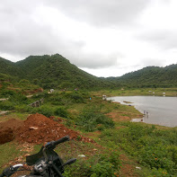
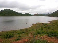
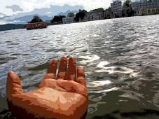
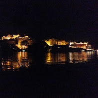
Chandni village Tehsil Girva Near Arambagh Resort Udaipur is a place that gives you peace and relax full of grenery and water from Tidi dam.
0 Comments
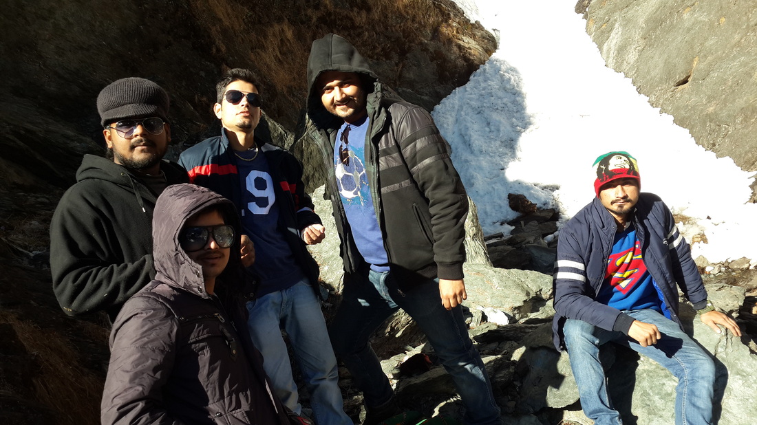
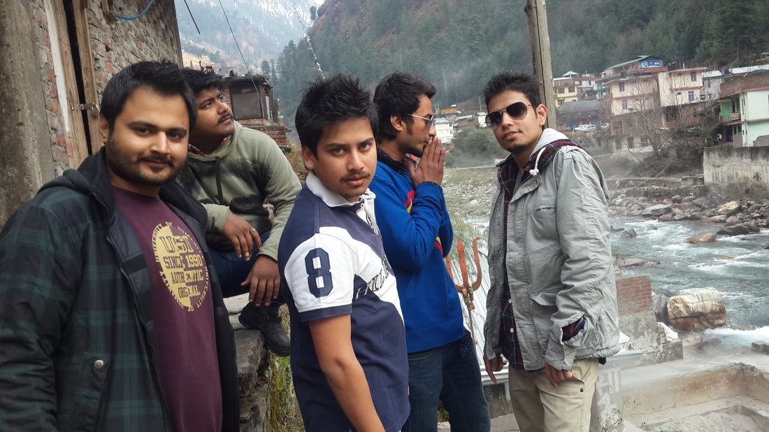
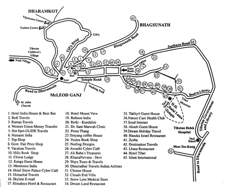 McLeod Ganj (also spelt McLeodGanj or Mcleodganj) is a suburb ofDharamsala in Kangra district of Himachal Pradesh, India. It is known as "Little Lhasa" or "Dhasa" (a short form of Dharamshala used mainly by Tibetans) because of its large population of Tibetans. The Tibetan government-in-exile is headquartered in McLeod Ganj. It has an average elevation of 2,082 metres (6,831 feet). It is situated on the Dhauladhar Range, whose highest peak, "Hanuman Ka Tibba", at about 5,639 metres (18,500 feet), lies just behind it.Population • Total 11,000 (approx) Me and my friends went there on 1 july 2015 to celebrates one of my best friend birthday bash i:e on 3 july. we went triund which is one of top sight of mclodganj.
The major towns near McLeodGanj include Dharamshala, Palampur, Kangra, Sidhbari, Tatwani and Machhrial. Other nearby spiritual attractions include Chinmaya Tapovan (a Hindu retreat centre), Osho Nisarga (an Osho retreat centre), and Chamunda (a pilgrimage place for Hindus). Other tourist spots include: Triund HillTriund is a ridge that overlooks the Dhauladhars. The ridge elevation is between 2,810 and 2,875 metres. It is a one-day trek 10 kilometres (one way) from McLeod Ganj bus stand and under 6 kilometres (one way) from Galu temple near Dharamkot. The trail is rocky and cut in steps at some places. From Galu temple the trail starts as a gentle ascend till Magic View café. After the café, the ascent is a tad steeper, finally cumulating in a steep final one kilometre stretch through a forest of Deodars and Rhododendron. This final stretch through the woods is known as 22-curves, because of the 22 switchbacks that one has to walk through to get to Triund. It is advised to carry your own potable water as bottled water costs 50 Rs / bottle at tea shops in Triund 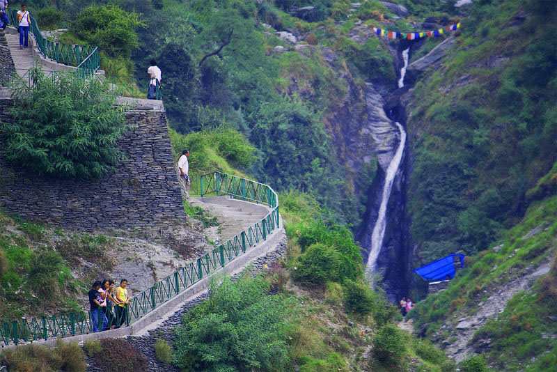 bhagsu-waterfall-mcleodganj Tibetan sitesThe most important Buddhist site in the town is Tsuglagkhang or Tsuglag Khang, the Dalai Lama's temple. It has statues of Shakyamuni, Avalokiteśvara, and a statue of Padmasambhava (Guru Rinpoche). Other Buddhist and Tibetan sites in McLeod Ganj include the Namgyal Monastery, the Tibetan Institute of Performing Arts, Gompa Dip Tse-Chok Ling (a small monastery), the Library of Tibetan Works and Archives, Gangchen Kyishong (called Gangkyi for short by Tibetans and the premises of the Tibetan government-in-exile), Mani Lakhang Stupa, Nechung Monastery, and Norbulingka Institute, which is 8 kilometres away. The 17th Karmapa, Ogyen Trinley Dorje, lives near Dharamshala, in Gyuto monastery in Sidhbari.  way to triund - like a way to jannat subcribe my channel :-https://www.youtube.com/playlist...
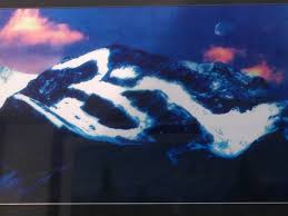
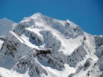
Visit my travelling experience :- thakurabhishek.weebly.com add me on facebook ;- https://www.facebook.com/Abhirchujji  Om Parvat (also Adi Kailash, Little Kailash, Jonglingkong Peak, Baba Kailash, chhota Kailash) is a mountain in theHimalayan mountain range, lying in the Darchula district of western Nepal and in Pithoragarh District, Uttarakhand, India. It is considered sacred by Hindus and its snow deposition pattern resembles the sacred 'OM' (ॐ). Its appearance is distinctly similar to Mount Kailash in Tibet. Near Om Parvat lie Parvati Lake and Jonglingkong Lake. Jonglingkong Lake is sacred, as Mansarovar, to the Hindus. Opposite to this peak is a mountain called Parwati Muhar. The Om Parvat is the fruit of discord between India and Nepal who do not reach agreement about the border line between the two countries. The Om Parvat is currently on the Indo-Nepalese border face "Om / ॐ" in India and the back of the mountain in Nepal.OM Parvat is the magical and inspiring Himalayan mountain peak that rises to an altitude of 6191 m lying in the Darchula district. This mountain is famous for the miracle of nature as it poses an impression of OM naturally which is formed with deposition of snow against black background of the mountain.OM is a holy Hindu mantra and is so clearly visible on this mountain. During the months of August – September the dot (bindi) on the semi circle of the mantra is also seen visible. According to the Hindu legends there are eight such OM symbols in the Himalayan Mountains and at present the world has been able to discover only one which we know as – OM Parvat. By far the most magnificent and thrilling of one's experience would be in winter when the whole lake freezes hard, and again in spring when the ice breaks and melts to clear blue waters. It is only the inspired poet or the divine artist with his magic colours that can, for instance, describe and represent adequately the beauty and grandeur of sunrise and sunset on the lake. The water of Mansarovar is as sweet as that of any river or of any glacial lake. The holy manas provides fine caves, camping ground and good sites to pilgrims. At certain places the site is rocky or sandy. On full moon nights, with the full moon overhead, the scene is simply indescribable. At sunset the whole of the Kailas range on the north becomes a fiery region all of a sudden, throwing an observer into a trance, and by the time he returns to consciousness he sees only the Silvery Peak in front. The weather is always uncertain. One moment you have scorching Sun, the next moment it begins to hail and snow and shortly after having a nap and coming out of your camp, you will see a clear blue sky and bright Sun above and a bed of pearl-like hail and white snow on the ground. 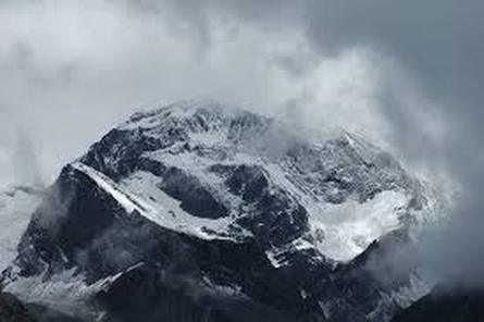 How to reach om parvat :- Day1: Delhi reporting, Departure at Night for Jageshwar (413 Kms by Bus) (1900mts.) Tip 1:If you are planning to go by flight then make sure that your swiss knife is in your Main bag, otherwise during security checking you will lose your valuable swiss knife. Tip 2: Delhi Taxi drivers are thieves. They will charge you around Rs.700-800 for dropping. Best way is call your Hotel and ask them how much should you pay for taxi. Also give mobile phone to taxi driver so that he will understand detailed address and will not ask for extra money. Day2: Arrival Kathgodam, proceed to Jagehswar Remember to see: Temple of lord shiva and Museum Day3: Jageshwar- Dharchula (Via Patal Bhuvneshwar) (330Kms) (920mts.) Tip 3: If you have omitting problem in bus then carry medicines and toffeess Tip 4: Only BSNL Mobiles works in Dharchula. After Dharchula Mobile phones will not work. At all camps BSNL Landlines are available. (Call rates are higher Rs.6/ per minute) Also note that at ITBP camps phone call rates are Rs.1 per minute. Remember to see: Patal Bhuvneshwar Day4: Dharchula-Tawaghat/Pangu/Narayan Ashram-Sirkha (54 kms by bus, 6kms by trek) (2560mts.) Remember to see: Maitree Bridge Nepal, Narayan Ashram, Shades of kali river Tip 5: Distribute/ bifurcate Luggage in 3 Groups. a) For Base camp Dharchula (Extra Money, valuables etc) b) For carrying - small Trek bag (Basic things for trekking, cloths pair, valuables which are not kept at base camp, camera, charger, Torch, Dry fruits, Medicines, Chocolates, Biscuits ) c) For carrying - main bag (All remaining Luggage) Note that you will get your Luggage after 3 days and not daily, so you have to manage accordingly. Tip 6 : Decide about Pony & Potter Pony - Horse ride if you are unable to walk for around 20 kms per day. Charges are around Rs.58 per km (Package deal around Rs.10,000/-) Potter - For carrying your small bag during trekking. Charges are around Rs.52 per km (Package deal around Rs.8,500/-) Tip 7: Remember to buy stick. Stick will keep you in trekking. You will not get professional stick in Dharchula. Simple stick is available for Rs20 Good quality stick- a) Light weight b) Thinner at upper side c) Strong d) Height upto chest Tip 8 :Cover your Luggage using plastic for saving from Rain fall. You will get plastic in Dharchula Day5: Sirkha- Gala (14kms by trek) (2440mts.) (Start 5:30 AM- Finish 1:00 PM ) Tip 9: How to walk in Mountains Always carry stick. walk with very short feets at a time. Take small steps. In trekking beware of two enemies a) Sitting for taking Rest and b) Taking water. Never sit during trek. If you want to take rest then take rest in standing position. While walking avoid taking water. If you feel thirsty then take little bit of water sip. Keep your mouth close. wear cap in such a way that you can see only your feet and nothing else. If you want to see beauty of mountains then stop and see mountains. Focus on road. seeing beauty while walking is very risky. Tip 10: About timing and shortcuts In Himalayas there is no guarantee of clean whether after 2:00 PM. Good policy is start early in the morning and reach destination before 2:00 PM. walking speed in mountains will be around 1.5 to 2 km in a hour. Avoid taking shortcuts in mountains. Remember that shortcuts are for local people. shortcuts will consume more of your energy. In this trek you have to walk for 18 km daily, so maintaining energy throughout the trek is very important. Tip 11: OM chanting 250 km means around 5 to 6 lakhs feets. So you can chant OM with every feet of walking. With lots of talking also, easily you can chant 1 lakh OM during trek. If you are music listener then carry Mp3 player. Day6: Gala- Budhi (21kms by trek) (2680mts.) (Start 5:00 AM- Finish 4:45 PM ) Tip 12: This days trek is Toughest. Almost 12 hrs trekking is required. You really have to learn "How to walk." Maintain speed, try to reach before 2:00 PM more you take time to complete, more difficult it will become. For this day carry a) Electrol (Glucon D contains glucose for instant energy or depletion of energy , Electrol contains essential salts ,which needs to be supplemented in dehydration.) b) chocolates ( Melody, Toffees containing sugar etc) Tip 13: Treat "Tea = water" You are going up. Here you will not feel thirsty. Cold will always be there. To maintain water level in your body drink Tea. It will save you from cold, gives water content and also provides Glucose. Drink Tea at every possible place. Day7: Budhi- Gunji (17Kms by trek) (3220mts.) (Start 5:30 AM- Finish 3:00 PM ) First 3km Trek is difficult. After this you will enter in a Dreamland above the clouds. Remember to see: Different Types of flowers, Garbhang (sinking city), Jilebi Hotel before Gunji camp Day8: Gunji-Kutti (19 Kms by trek) (3600mts.) .) (Start 6:30 AM- Finish 2:00 PM ) Road is very beautiful with very little ups and downs. This will be the day that you start enjoying mountains. Remember to see: Annapurna Mountain, vedvyas city, vally of flowers at kutti Tip 14: There is going to be very cold at kutti in night. Also High altitude problems may start. Take care of cold. Day9: Kutti- Jolingkong (14Kms by trek) (4572mts.) (Start 6:30 AM- Finish 1:30 PM ) High altitude problems may start. very cold. During this day avoid exposing your body to wind. Here winds temperature will be almost around to 0. Tip 15: Try to visit "Parvati Sarovar" on same day. Probably Next morning weather will be clear and you can see Gauri kund and Adi kailash Day10: Jolingkong-Adi-Kailash/ Parvati Sarovar-Jolingkong- Kutti (21Kms by trek) (3600mts.) Gauri kund is located above glassier and it is very risky to go there. KMVN and ITBP will not give permission to go to Gauri kund. But in a good faith and only with local potter and with your risk, you can go to Gauri kund. Day11: Kutti-Gunji (19Kms by trek) (3220mts.) Day12: Gunji- Kalapani- Nabhidhang (18kms by trek) (4246mts.) (Start 6:30 AM- Finish 2:30 PM ) Remember to see: Kali Temple, Nag parvat, Parvati's Nabhi, OM parvat, Crashed Helicopter (Ved vyas' cave is also at kalapani, but it is not allowed to visit ) Tip 16: Rule is "If you are able to see Nag parvat then only you can see OM parvat" From kali temple at kalapani check if you can see left hand sides mountains top before moving. If weather is clear at kalapani then only you can see OM parvat. Day13: Nabhidhang- Kalapani (8kms by trek) (3600mts.) Day14: Kalapani- Gunji (10kms by trek) (3220mts.) Day15: Gunji-Budhi (17Kms by trek) (2680mts.) Day16: Budhi-Gala (21kms. By trek) (2440mts.) Budhi to Gala is easy than Gala to Budhi. So, dont panic. Remember to ask for apples in Budhi Day17: Gala-Sirkha (14 kms by trek) (2440mts.) Day18: Sirkha-Dharchula (54Kms by bus) (920mts.) Day19: Dharchula-Almora(230Kms by Bus) (1706mts.) Day20: Almora to Delhi via Nainital (Departure at night for Delhi) (390kms by Bus) (1920mts.) Day21: Delhi (Arrival morning) Before noon Luggage Tips 1.Wind proof Jacket 2. Sweaters 3. Monkey cap 4. Woolen Socks 5. Cotton socks 6. Jeans / Pants -2 7. Shirt/ T- shirt 8. Sun glasses 9. Trekking shoes - 2 pairs 10. Water bottle 11. Torch light 12. Rain coat 13. Plastic sheet for water proofing your luggage 14. Sunscreen lotion 15. Match box 16. Candles 17. Rubber Slippers 18. Medicines 19. Belt pouch for camera/ money/ medicines and documents 20. Dry fruits 21. Biscuits 22. Glucose/ Electrol /Glucon D 23. First aid 24. Winter wear 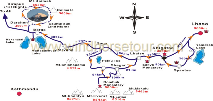
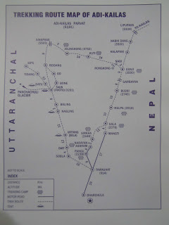
If you are Planning for Trekking :- Inner Line Permit is required for this trek, required paper work to be submitted at SDM office Dharchula. 1. Application form in duplicate and photograph pasted on top of the form. 2. Address proof which can be driving license, voter id or passport. 3. Medical certificate. Telephone numbers of SDM office is 05967-222207/05967-222817.If your travel is arranged by KMVN, it will take the responsibility to get your necessary permits arranged. Facilities: Accommodation, Transport, Food( Vegetarian), Guide charges, Transport for Luggage up to 20kg per person.. or else do let me inform i will make a complete arrangement for you this is really a breathtaking place in India. ONE MUST VISIT THIS PLACE IN HIS LIFE ...!! TRIP SUMMARY
Destination: Adi Kailash & OM Parvat Maximum Altitude : 6191 Mtrs Grade : Hard Trek Best Season: June to September Trek Length: Around 250 km Trek Duration : ( 22 days/21 nights) 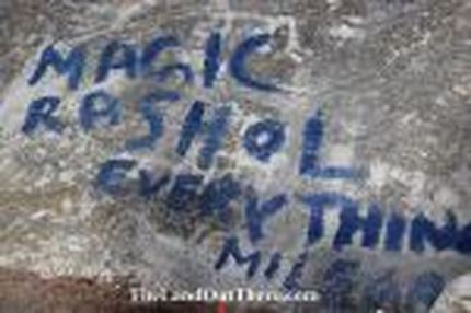 Hidden deep within the foot hills of the Himalayas lies a small village by the name of Rasol which is at an altitude of around 10,000 feet above sea level and has not more than 75 houses. Rasol is located in the Parvati Valley which is in the state of Himachal Pradesh. The only option to reach the village of Rasol is to hike from the town of Kasol. The hike takes around three to four hours to reach with a hand full of steep climbs which are very much do able for even a rookie hiker. While hiking to Rasol backpackers will reach the village of Chalal which is around 20 minutes from Kasol. Chalal is a good place to stop and have some breakfast or brunch since provisions for anything else to eat along the hike is very less. Chalal is also a good option to make base before the hike to Rasol. While hiking to Rasol one thing that everyone will spot is plenty of magic Rasol sign boards on rocks and tree barks pointing in the correct direction of the village. Magic Rasol is in reference to the hasish that is sold in this village. The hasish from Rasol is supposed to be one of the finest and many consider it to be on power with the stuff from Malana. Rasol can be spotted from around 70% of the hike and the first thing one will notice in Rasol is the village temple sign board. Which states that entering the temple premises will lead to a heavy fine of Rs 2000. The temple is of Jamdagni Rishi a form of Lord Shiva. Inside the temple compound is a small stadium kind of a arrangement which has steps for villagers to sit on. During the day time men from the village of Rasol can be seen playing a very unique game called Panjee which is only played here in Rasol and in the village of Malana. This game Punjee is supposed to be similar to chess but upto four can play the game at a time and players have to throw a bunch of half cut bamboo sticks to determine how many places their coins move. The game attracts a lot of local crowd. Wandering through the lanes of Rasol and you will see nearly every second person from the village spinning wool or asking you to buy hasish. The kids are always busy playing among themselves. Most of the villagers from Rasol have never ventured outside the valley with the town of Bhuntur being their furthest. Accommodation at Rasol is limited to backpacker guest houses which have common washrooms and rooms with noting more than just a bed. The rooms in Rasol are spacious and can easily accommodate around four to five people in a room. Eating options in Rasol are not too bad either with all guest houses having a restaurant attached which serve really tasty food. The food is priced a bit steep since porters have to physically carry all the supplies from Kasol. Rasol is a good place to visit all year round. The weather is generally always good other than during the winter months from end of November to mid February. Good hiking shoes and a bottle of water along with a wooden stick to aid you in the hiking is a must for all. The village of Rasol is a must visit for all those backpackers who want to experience the magic from the Rasol cream or super cream. For others the hike and the guest house view make this village worth visiting while in Parvati Valley.  This is what i called "Jannat" of peace...!!
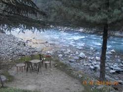
 Located not too far away from the backpacker town of Kasol in Himachal Pradesh is the tiny village of Chalal. The village of Chalal is located at an altitude of around 8366 feet above sea-level and is located on the banks of the River Parvati. Chalal can only be approached by foot from the town of Kasol by crossing a cable suspended bridge that has been built over the free flowing Parvati river. After crossing the bridge take the trail leading to the left and follow the narrow path that takes hikers through the forest of tall pine trees. The trail is very scenic and not at all difficult to do. Five minutes into the hike travelers will see a few houses which are generally mistaken as the village of Chalal, but those are not a part of the village but guest houses for backpackers. The trail leading to the village of Chalal is very well marked and easy to find. Just before the entrance to the village the trail takes backpacker to the banks of the River Parvati. It is highly recommended that one stops there and spends some time just listening to the gushing sound of the river. The banks of the river has plenty of medium and huge rocks where travelers can sit and chill by the river and smoke some pot, if they like. The village of Chalal is very not too big and is also a base village for the hike to magic Rasol. Nearly all the houses in Chalal are old, traditional wooden houses which are made by keeping in mind the severe winter and heavy monsoon. That’s why all the houses have their ground floor only for storage and to keep their animals. The families live in the upper section. Just like the rest of Parvati Valley, the main occupation of the people in Chalal is animal husbandry and Hash (cannabis) farmers. Chalal is another village which is well known in the valley for its Hash. The quality of cannabis from Chalal is supposed to be of mid range quality. Over the last few years, Chalal has become the hub for trance and psychedelic parties that happen deep in the forest near the village. These parties go on for days if not a week. The major crowd puller for these parties are world class DJ’s who come all the way to this beautiful valley just to perform for the music festival. There is an entry fee for these parties which is not too affordable any more. Accommodation in the village of Chalal is easily available but mainly to suit the needs of those backpackers who intend on making Parvati Valley their home for a month if not longer. The guest houses mostly have shared washrooms and the rooms are very basic with just a bed. Most of the older hippies have made Chalal their home in Parvati Valley. Chalal has plenty of cafes which have amazing river side locations and superb food. The food served in these cafes are mostly to cater to the needs of western travelers so pastas, pizzas and salads are served in nearly all the cafes along with paratha’s, noodles and vegetarian thali. The best time to visit the village of Chalal is during the summer months from April to mid-June and from September to November since the weather is perfect and ideal for backpacking. Chalal is an ideal village to visit to just relax and unwind and also is home to some of the best parties in the whole valley if not the whole country. Chalal is a must visit place for everyone who visits the valley. personally i love this place where there is only sound of gigantic parvati valley and music.It is known as Backpacker's Haven.I SPEND 31 DEC 2014 NEW YEAR with my friends.. it is really a fuckin awesome place for peace.. 
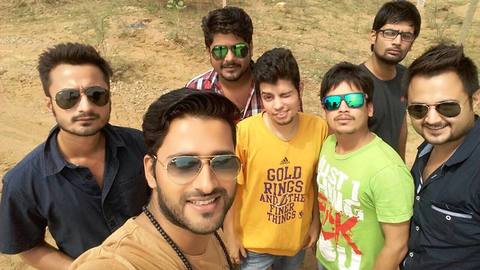
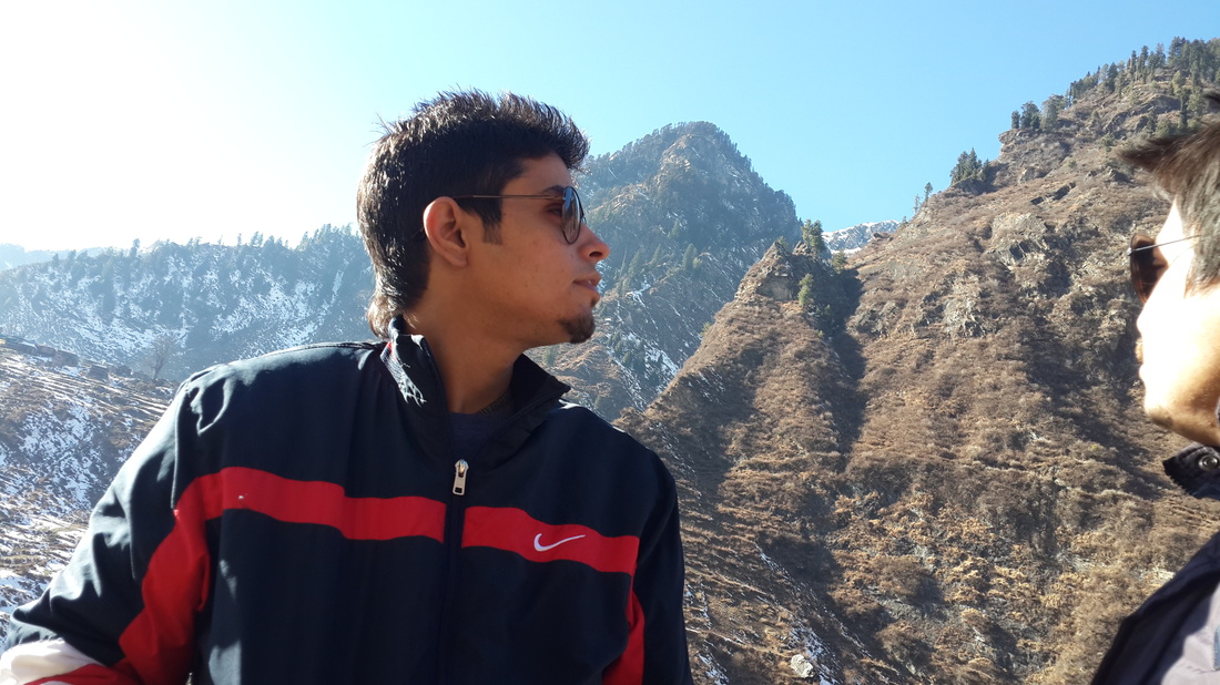
 Ayush Born in 3 july. He is kind of adventurous man in my life i ever met ; as i was with him from nursery standard when we were learning how to write and say "A" for apple "B" for boy.... he is always looking for peace and adventure ...!!
 Pawan his name resembles to him same he is fond of Outdoor adventurous activities.he is like a ideal for me,By proffesionally i learnt a lot of things from him..When i heard name of pawan - i saw the glimpse of black accent and heavy rainfall in shimla national highway...!!
 Tyagi he is most adventurous dangerous guy i have ever met in life . he takes breath in himachal pradesh "DEVO KI BHUMI".. great man heads off to you ..!!  Dikshant is kind of moto cross adventurous man he also do what he wants to do.He sparks his adventurous moments in lot of different ways ... basically he modifies everything what he wants same as in the way of adventure..!!
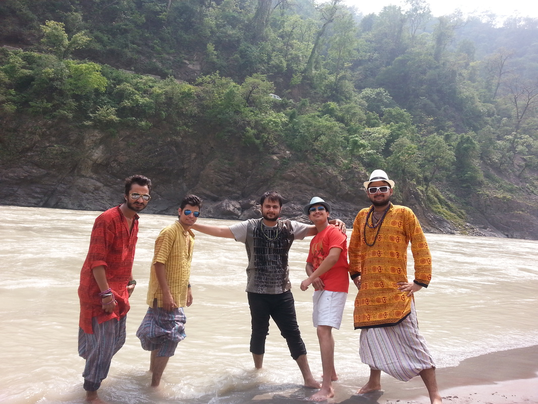
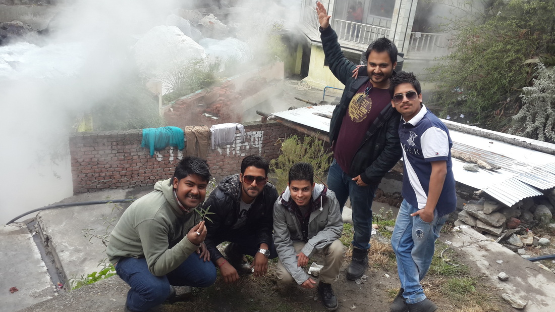
THIS WAS THE F#CKIN AWESOME NEW YEAR 2014 WITH AYUSH,RAHUL,MAYUR,PAWAN,DIKSHANT
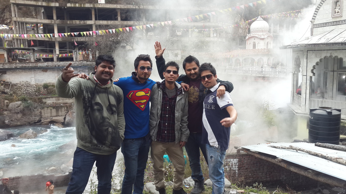
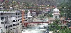
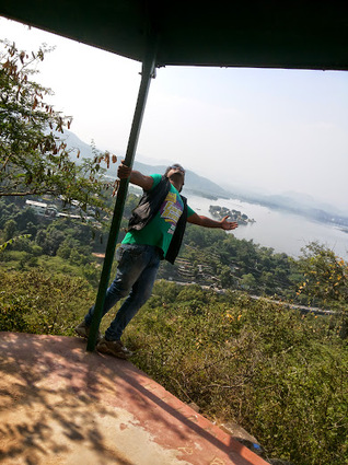
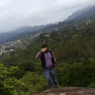
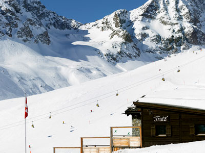
WE LIVE YOUNG - WE LIVE FREE - WE ARE THE LEGENDS.........!!! Kufri is a small hill station in Shimla district of Himachal Pradesh state in India. It is located 13 km from the state capital Shimla on the National Highway No.22. Kufri with NH-22, Shimla district. The name Kufri is derived from the word "Kufr" meaning a lake in the local language. Kufri is located at 31.10°N 77.25°E. It has an average elevation of 2,743 metres (9,000 feet).The region around Shimla including Kufri was once a part of the Kingdom of Nepal until the area was ceded to the British Raj as part of the Sugauli Treaty. This region remained obscure from the rest of the world until the British 'discovered' it in 1819. 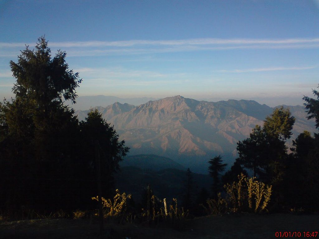 View of Himalayas from kufri.... 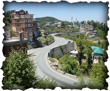 N.H. NO-22 Way to kufri... N.H. NO-22 Way to kufri... Just 18 Kilometers from Shimla Kufri at an altitude of 2510 m is the most popular tourist spot around Shimla. The Kufri Shimla distance can be covered in half an hour by car. This place is famous for hiking, skiing, beautiful scenes and a cool environment. The Skiing season spreads between November to February and the tourist inflow is at its peak during winters because everyone lands up here to ski and throw snowballs at each other. Kufri’s altitude is 500 meters higher than Shimla, so this place is colder than Shimla. On an average the temperature in Kufri is 3 to 5 degrees less than Shimla. Kufri receives more snowfall than Shimla.Kufri weather is pleasant in April May and June months with nature at its best. December January and February months are famous for winter sports and playing in the snow. Due to heavy snowfall in winter months the roads get blocked and there is disruption in traffic also. Another adventure option in Kufri is Yak and Horse riding. This is one of the best way to enjoy the landscape. Passing through the exuberantly green woodlands, sky soaring mountains and gurgling rivers, the journey through this mode of will give you excellent delectation and gratification Shiing season in Kufri is from December to February. During the winter months bands of ski enthusiasts from all over the country drift from the snowy fields of Kufri to Narkanda in search of the finest ski slopes on which to flaunt their expertise. There is a wide range of Skiing slopes in Kufri, where there are slopes to suit ever king of skier. There’s a beginner’s run, an advanced slope and slalom run. Government too has taken care by offering ski courses, and gives out equipment on hire at Kufri. To indulge in some difficult skiing trek, then try this sport at Mahasu, situated above Kufri. 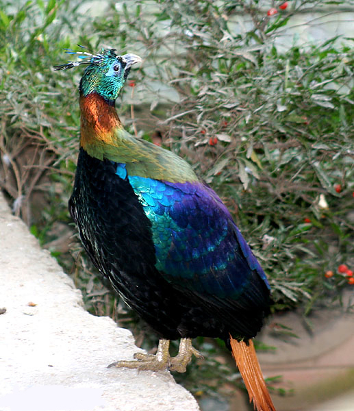 Monal bird of kufri [himachal pradesh] 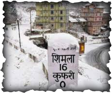 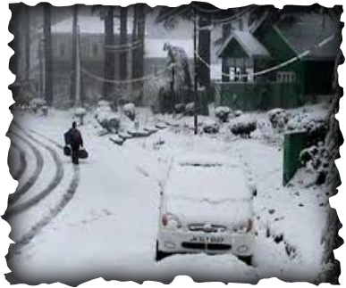 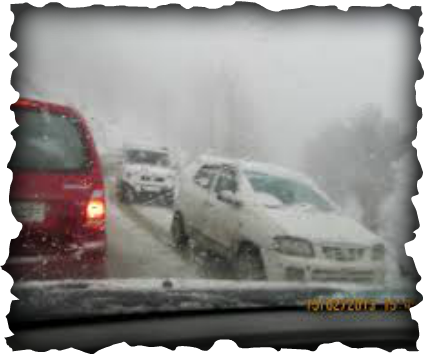 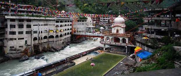 Manikaran (Punjabi: ਮਨੀਕਰਨ) is located in the Parvati Valley between the rivers Beas and Parvati, northeast of Bhuntar in the Kullu District of Himachal Pradesh. It is at an altitude of 1760 m and is located about 45 km from Kullu. This small town attracts tourists visiting Manali and Kullu to its hot springs and pilgrim centres. An experimental geothermal energy plant has also been set up here. Kullu-Manali Airport at Bhuntar: 37 km Kullu town: 45 km Manali town: 85 km According to hindu belief
According to sikh belief According to the Sikhs, during third Udasi, his founder Guru Nanak came to this place in 15 Asu 1574 Bikrami with his disciple Bhai Mardana. Mardana felt hungry and they had no food. Nanak sent Mardana to collect food for the langar (the Community Kitchen). Many people donated atta (flour) to make Roti(bread). The one problem was that there was no fire to cook the food. Nanak asked Mardana to lift a stone and he complied and a hot spring appeared. As directed by Nanak, Mardana put the rolled chappatis in the spring to his despair the chappatis sank. Nanak then told him to pray to God saying that if his chappatis float back then he would donate one chappati in His name. When he prayed all the chappatis started floating duly baked. Nanak said that anyone who donates in the name of God, his drowned items float back., , ,
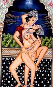
Cannabis was also an important part of the Tantric religious yoga sex acts consecrated to the goddess Kali. During the ritual, about an hour and a half prior to intercourse the devotee placed a bowl of bhang before him and uttered the mantra: "Om hrim, O ambrosia-formed goddess [Kali] who has arisen from ambrosia, who showers ambrosia, bring me ambrosia again and again, bestow occult power [siddhi] and bring my chosen deity to my power." Then, after uttering several other mantras, he drank the potion. The delay between drinking the bhang and the sex act was to allow the drug time to act so that it would heighten the senses and thereby increase the feeling of oneness with the goddess.
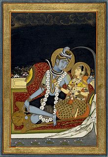
Shiva bearing the descent of the Ganges River as Parvati and Bhagiratha and the bull Nandi look, folio from a Hindi manuscript by the Narayan, circa 1740
Kasol is a village in Himachal Pradesh, northern India. It is situated in Parvati Valley, on the banks of the Parvati River, on the way between Bhuntar to Manikaran. It is located 42 km east of Kullu at the height of 1640 meters. Kasol is partitioned into Old Kasol and New Kasol on the either side of the bridge. Kasol is at distance of 5 kilometre from holy place Manikaran.. A Mini Israel In Himachal Pradesh Kasol has recently transformed into a hub for backpackers, who are attracted to the scenic valley, untouched hills, low population, and good climate throughout the year. Kasol is also a base for Himalayan trekking, to SarPass, Yanker Pass, Pin Parbati Pass and Khiriganga. Most of the trekking is organized by the Youth Hostel of India and the base camp for the Sarpass Trek is at Kasol. Visitors from Israel are common in Kasol and one can see the Hebrew language banners throughout the valley. Kasol is also Know as Mini Israel in Himachal Pradesh. The shops in the village of Kasol have western food and clothes. There is only one school which has classes up to 7th grade. The nearest college is in Kullu. The recent inflow of Israeli tourists has triggered mushrooming of restaurants, hotels and shops catering to their needs. Kasol is inhabited mostly by tourists from Israel which is why most of the hoardings are in Hebrew and the Israeli Shakshouka, a dish of poached eggs in tangy tomato gravy along with hummus and pita bread will definitely drown you in its’ rich flavours. The Israelis in India move from Kasol to Paharganj in Delhi to Goa with an elan as if each is in their neighbourhood. Mysterious Himachal Kasol is ideal for a vacation if you want to chill in the lap of nature. The village is an open space by the banks of the Parvati River where one can spend lazy afternoons. The river abounds with trout and is the perfect place for angling. However, permission from forest department is required for trout fishing in the river. Parvati river at Kasol is ideal for white water rafting. It isn’t clear if the name Parvati valley has anything to do with the manufacture of Hashish or marijuana that is grown in this part of India but the melancholy beauty of the place will leave you wanting for more. Visitors are attracted to the town because of its hospitality, beautiful environs, and wild charas, a hand-made hashish made from the cannabis that is plentiful to the area. With Parvati river gurgling and the formidable snow-capped mountain lurking from a corner, reading a book in a café by the river would be an interesting thing to do but while in Kasol and not indulging in trekking would reckon the getaway incomplete. 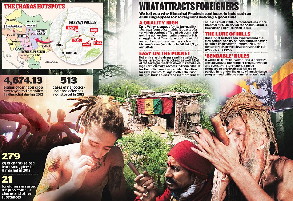
 THIS IS THE F#CKIN AWESOME PLACE IN KASOL = "THE KASOL CAMP" 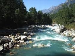 cold water makes you chiller and more chiller .... 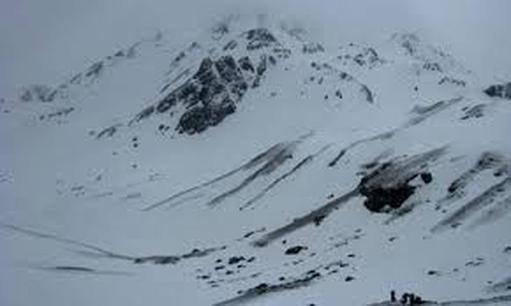
I saw the dark white parvati valley which i will never forget ,,sometime i see in my dreams the glimpse of it...
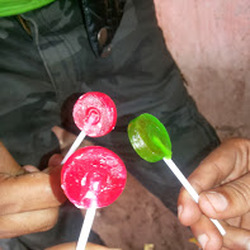 RECENTLY HAD A LOLLYPOPS WITH THE FRIENDS AT THE AGE OF 22+ WHAT A CRAZY GUYS I HAVE MET ; I LOVE YOU GUYS .... 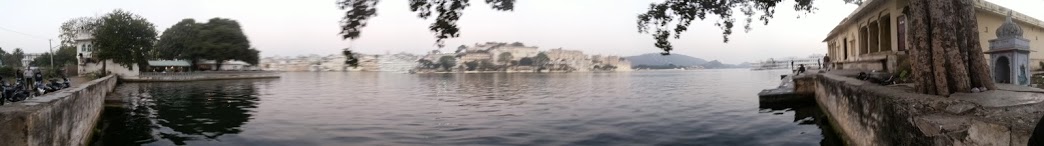  WHEN U FEEL COLD IN ICE ITS LIKE TO BURN A BUNDLE THAT KEEPS U HOT...!! I FOUND THE PEACE WHERE THERE IS NO ONE TO STOP YOU EVEN YOU SHOUT AT THE TOP OF HILLS ..THIS IS WHAT I CALL - "MR. EXPLORER"
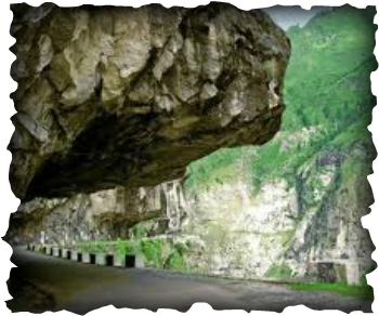
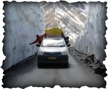
Gata Loops is a name that is unknown to everyone except for a few who have traveled on the Manali Leh highway. It is a series of twenty one hairpin bends that takes you to the top of the 3rd high altitude pass on this highway, Nakeela, at a height of nearly 16000 ft. People who do know the name Gata Loops know it because of its stunning location, breath taking scenery around it and the difficult ascent. But that is not all, there is also the ghost who haunts these loops that only a handful know about. During my last trip to Leh, we were staying at a camping site in Jispa. There were no other guests there and all the other tents except for the one that we were occupying were empty. It was slightly past 9 pm and my fellow traveler Shoaib had already gone to sleep after the day long journey from Manali to Jispa but despite being tired myself, I just could not get myself to sleep. I was standing outside our tent when i noticed that the kitchen was still open. I walked over and found the guy who was running the camp preparing a cup of tea for himself. He asked me if I would like to have some and I immediately said yes. After comfortably settling down on a chair in the kitchen itself with a cup of tea in my hand, i stuck up a conversation with him just to kill some time. He proved to be quite a chatter-box himself and pretty soon was telling me almost everything about himself and the place, how cold it gets here, how he moves to Manali in winter and so many other things. And thats when he asked me that question, "Do you know about Gata Loops?" He asked while sipping down the tea. "Yes I do, we will be crossing it tomorrow" I replied. "No not that", He started sounding mysterious, "Do you know about the ghost?" "What ghost?" "There is a ghost that lives there. The place is haunted" "What?" I laughed, "Why would a ghost live there on the road, out there in the cold" "Its not his choice" He kept that serious tone and expression on his face, "He is bound to that place because his body is buried there" "Really? Who was that poor fellow? Someone who thought that this place is scenic enough to die here, be buried and just be here forever?" My tone was still of a mocker. "No, someone who was just unfortunate enough to get stuck on the road and ended up dead" "Tell me about it" Now I sounded curious and he started telling me the tale of the trucker who died on the gata loops. Several years ago [he couldn't tell me exactly how many years ago], it was late October when a truck with its two travelers, the driver and a cleaner, crossed Rohtang and moved on its way towards Leh. It had already started to snow at a few places and the driver was warned but he had no choice. He had a time-line and had to reach Leh which meant that it was too late for him to turn back and take the Srinagar Leh highway which was still comparatively safer. It was the last truck to cross Rohtang as it snowed heavily the very same evening at the top and the pass closed. Kunzum Pass was already closed weeks ago and there were no vehicles coming from Kaza as well which means that it was the last truck plying on Manali Leh highway. The driver managed to bring the truck safely all the way to Gata Loops but this is where disaster struck. On one of the loops, his truck broke down and came to a complete halt. After trying for hours, the driver couldn't fix whatever was wrong with the vehicle. They waited and waited but no one crossed them by because they were the last vehicle on the route. so the driver decided to walk to a nearby village and get some help. Cleaner however was ill and not in a condition to walk. He was so terribly ill that he could barely stand up but what was he suffering from our narrator couldnt tell. To add to this, Truck was also loaded and could not be left abandoned with the cargo because of the risk of getting robbed hence the cleaner stayed back with the truck to guard it and also because he was in no condition to walk. The driver walked and walked for miles until he found a tiny village but Alas, there was no mechanic there. He somehow managed to make a phone call to Manali to get someone to come and fix the truck but to his bad luck, while he was still waiting at the village, the weather closed in. It started to snow heavily and became impossible for the driver to get back to the truck. It took several days for the weather to clear and he was stranded in the village all this time. Finally help came from Manali and they all hurried back to Gata Loops, to the spot where the truck broke down only to find the cleaner dead. Poor chap was left alone on the road for several days in freezing temperature, in poor health, with no water and nothing to eat and eventually died of thirst, hunger and cold. The truck was fixed but it was impossible to drive it either to Leh or Manali because passes on both sides were closed. So the driver drove the truck to the village he was stranded in and waited there until it was possible to drive across Rohtang and return to Manali. The body of the cleaner was buried at Gata Loops by the villagers, right at the spot where he died. Next year when the highway reopened, people started noticing a strange thing. There was a beggar at Gata Loops who would waive at the passing vehicles to stop and begged them for water. Some people did not stop but the ones who did and offered the beggar some water saw the bottles drop right through his hands. The word spread and sure enough people were scared of the ghost who begged for water, thinking that it might harm them if they stopped or curse them if they didn't. In order to pacify the ghost, the locals set up a small temple at the spot where he was buried and made offerings of water. Since then, whoever passes by and is aware of the story leaves some water at the temple, as an offering. "Have you seen this ghost?" Was my question after the guy finished his story. "No" "Do you know anyone who has seen the ghost?" "No but tomorrow when you cross Gata Loops, look out for a dump of water bottles. Thats where the temple and the grave of the dead cleaner is" And sure enough, the next day while we were ascending on Gata Loops, I noticed a dump of water bottles in front of a small temple made of stones with a red flag fluttering on top of it. It looked weird and quite an eyesore if middle of such a scenic place but i also noticed that all the water bottles were full, seal packed. So is the legend of the ghost of gata loops where people still stop and make offerings of water. 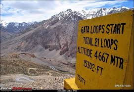 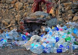 |
I do Travelling not only to satisfy myself but also gives smile to old people's who wants to visit thier parental place again once in a life.
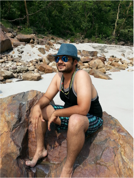
I am kind of adventurous person...looking for new adventure in life where you will feel relax and peace..my passion is to visit every place where you can get peace of mind..!! |


 RSS Feed
